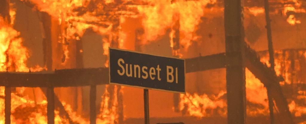
At least five people have died and more than 100,000 have been ordered to evacuate as uncontrolled fires burn through parts of Los Angeles into a third day.
Five separate fires are sweeping through parts of the city and the surrounding areas, with one of the biggest blazes, the Palisades fire, expected to be the costliest in US history.
Satellite images provided to Business Insider by Maxar Technologies show the trail of destruction the fires have left in Altadena and Pacific Palisades, two of the most heavily affected areas.
Houses burned to the ground in Altadena
Satellite images show houses burned down in the Altadena neighborhood of Los Angeles, one of the areas most affected by the Eaton fire.
According to the California Department of Forestry and Fire Protectionas of 3 a.m. Thursday local time, the fire had burned 10,600 acres in the area and continued to grow with 0% containment.
Palisades fire burning through western Los Angeles
Pacific Palisades, a neighborhood in the Westside region of Los Angeles, has also been devastated.
According to the California Department of Forestry and Fire Protection, the Palisades fire had consumed about 17,234 acres with 0% containment as of 4 a.m. Thursday.
The Palisades fire alone has already become the most destructive fire ever to hit Los Angeles County, CNN reported Wednesday, citing Cal Fire data.
East Altadena Drive
Houses and buildings on East Altadena Drive are almost unrecognizable in the image above from Wednesday.
Mayor Karen Bass of Los Angeles said during a press conference Wednesday evening that residents could receive more evacuation orders as wind conditions continued to be “strong and erratic.”
In an X post in the early hours of Thursday, she said firefighters would be working throughout the night to battle the blazes.
Tuna Canyon Road closed until further notice
Tuna Canyon Road, which connects Malibu and Topanga, was covered in smoke Wednesday, and fires burned through nearby buildings.
In an X post on Wednesday night, the California Department of Transportation said highways were fully closed at various locations because of fires or wind-related incidents.
Meanwhile, ride-hailing companies such as Uber and Lyft were offering free rides to evacuation centers.
A historic windstorm
The fires are still burning, and satellite imagery from Wednesday showed the scale of the fires in Altadena.
The National Weather Service called the windstorm “life-threatening and destructive.”
Courtney Carpenter, a warning-coordination meteorologist at the National Weather Service, said the fires would likely continue over the coming days.
“We’re not out of the woods yet,” she said, pointing to winds expected to continue through Friday afternoon and dry weather conditions.
This article was originally published by Business Insider.
More from Business Insider:


